When we think of Roman cities, we tend to think in monuments. But Rome was built first on streets.
In ancient Carthago Nova — today’s Cartagena — two main axes shaped the city: the Decumanus Maximus, running east to west, and the Cardo Salvius, running north to south. Together, they organised movement, power and daily life. Before entering a theatre or a forum, you were already inside Rome simply by walking these roads.
The Decumanus Maxima: an urban spine
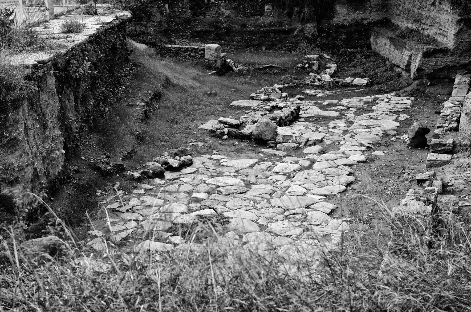
The Decumanus Maximus in Cartagena.
The Decumanus Maximus was Cartagena’s main east–west artery. Adapted to a hilly landscape and a busy harbour, it was not a ceremonial boulevard but a working street. Shops opened onto it, carts passed through it, conversations and transactions filled it. This was Rome as routine rather than spectacle.
The Cardo Salvius: life at street level

The Cardo Salvius in Cartagena.
Crossing the decumanus was the Cardo Salvius, the city’s principal north–south street. Its name hints at importance and local pride. Lined with houses, workshops and public buildings, it connected residential areas with the civic and economic heart of the city. This was a street designed for presence, not speed.
Roman Cartagena (Carthago Nova) you can still walk today
What makes Cartagena special is that these streets are still visible. Near Parque de El Lago, sections of both the decumanus and the Cardo Salvius lie exposed at their original level. Wheel ruts, paving stones and drainage lines remain clearly readable. Here, Rome is not imagined — it is encountered underfoot.
Where streets became a city
The intersection of decumanus and cardo was the core of Roman Cartagena. From this logic flowed the forum, the theatre and other monuments. Streets came first; buildings followed.
Rome did not rule only through emperors and armies. It ruled through infrastructure, repetition and familiarity. In Cartagena, that logic is still written in stone.